Solar System
Mars Projection Map
December 18, 2007 · NASA
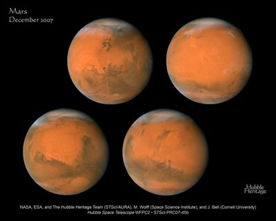
This map spans 360 degrees of Mars' surface, starting at a longitude line of 230 degrees on the left edge. It spans nearly to the north and south polar cap regions in Mars' latitude. This map is a composite of images taken with the Hubble Space Telescope's Wide Field Planetary Camera 2 in early December, just weeks before its December 18, 2007 closest approach.
About the colours
Blue: F410M Green: F502N Red: F673N
About the data
This image was created from the HST proposal 11361 : K. Noll (The Hubble Heritage Team, STScI), J. Bell III (Cornell Univ.), M. Wolff (Space Science Institute), H. Bond, C. Christian, L. Frattare, F. Hamilton, Z. Levay, M. Mutchler, and W. Januszewski (Hubble Heritage Team, STScI).