
Solar System
Topographic Map of Vesta’s Surface
September 4, 1997 · NASA
This topographic map of Vesta's surface, based on Hubble Space Telescope observations, is color coded to reveal altitude variations above a mean surface level. The southern pole is dominated by a depression (blue) which is a large impact feature.
More Hubble images of Vesta
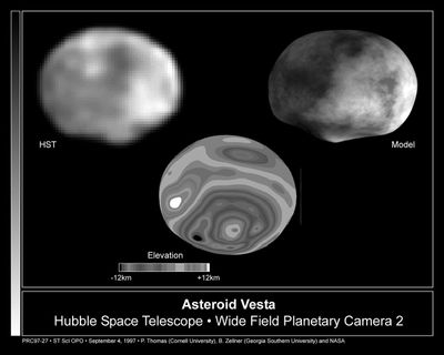 Hubble Reveals Huge Crater on the Surface of the Asteroid VestaSeptember 4, 1997
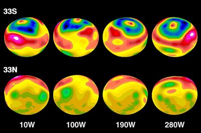 Topographic Map of Vesta’s Surface Modeled onto Elliptical ShapeSeptember 4, 1997
VestaSeptember 4, 1997
Color-encoded Elevation Map of VestaSeptember 4, 1997
Computer Model of the Asteroid VestaSeptember 4, 1997
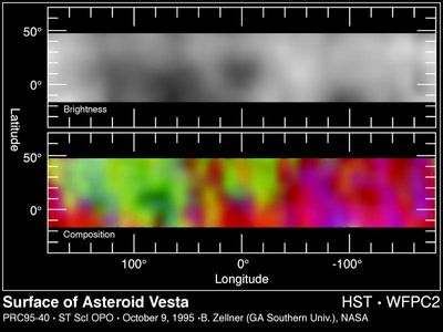 Hubble Maps the Asteroid VestaOctober 10, 1995
Hubble Follows the Rotation of the Asteroid VestaApril 19, 1995
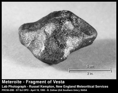 A Piece of the Asteroid VestaApril 19, 1995