
Solar System
Color-encoded Elevation Map of Vesta
September 4, 1997 · NASA
A color-encoded elevation map of Vesta clearly shows the giant 285- mile diameter impact basin and "bull's-eye" central peak. The map was constructed from 78 Wide Field Planetary Camera 2 pictures. Surface topography was estimated by noting irregularities along the limb and at the terminator (day/night boundary) where shadows are enhanced by the low Sun angle.
More Hubble images of Vesta
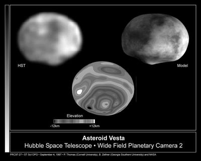 Hubble Reveals Huge Crater on the Surface of the Asteroid VestaSeptember 4, 1997
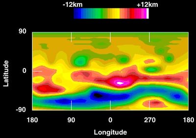 Topographic Map of Vesta’s SurfaceSeptember 4, 1997
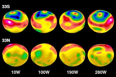 Topographic Map of Vesta’s Surface Modeled onto Elliptical ShapeSeptember 4, 1997
VestaSeptember 4, 1997
Computer Model of the Asteroid VestaSeptember 4, 1997
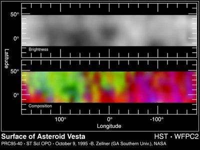 Hubble Maps the Asteroid VestaOctober 10, 1995
Hubble Follows the Rotation of the Asteroid VestaApril 19, 1995
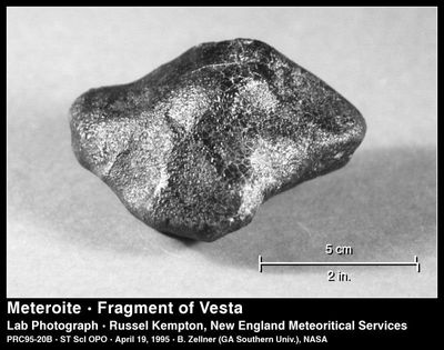 A Piece of the Asteroid VestaApril 19, 1995